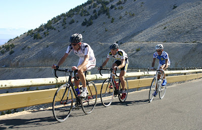
A new event on the gran fondo calendar is the multi stage "LA HAUTE ROUTE". Although it doesn't take place in Italy I thought I write about it as it comes very close to Italy on its way from Geneva to Nice, and it sounds like such a great challenge.
The first edition of the HAUTE ROUTE (the ‘high road’) is an exceptional cyclosportive (gran fondo) event involving 7 stages, 14 cols between Geneva and Nice, that will take place over 7 days from 21-27 August, 2011. Riders will be challenged as they climb over 14 legendary Alpine Cols between Geneva and Nice. 700 km, 18,000m of climbing, 7 days of pleasure and pain.
With more than 700 kilometres to cover and around 18,000 meters of altitude to climb and as much to descend, the competitors will have the amazing opportunity to measure themselves against 14 famous cols, including the Madeleine, Galibier, the Izoard and the Cime de la Bonnette on a route that climbs above 2,800 metres. The first edition of La Haute Route will stop in the prestigious ski resorts of Megève, Les Arcs/Bourg-St-Maurice, Serre Chevalier, Pra Loup and Auron.
The organizers are estimating between 500-600 entries for the inaugural event. Registration deadline for the Haute Route is 31 July 2011. Registration is Euro 630, lodging packages are available from the organizer.
Read all details at www.hauteroute.org
Course overview by Claude Droussent, Ex-Chief Editor of the newspaper group L’Equipe:
Saturday 20th August 2011: La Haute Route Village, Geneva
Sunday 21st August 2011 : Geneva – Megève (97 km)
"Beware! Neither the distance (97 km) nor the altitude of the first two cols of the Haute Route, the Colombière and the Aravis, should scare you. However the ascent of the Colombière by its north side is a “two-faced” friend. The first ten kilometres, up to the Reposoir, are “soft”; the last six surrounded by a rocky landscape have a gradient between 8.5 and 10%.
Once you have freed yourself from this first col of the week (1616 meters), the descent of the south side is not too punishing until Saint-Jean-de-Sixt. From there, you’ll head towards La Clusaz and then turn right for the last eight kilometres of the Aravis. It is a cool route with an average 5% gradient, green scenery, the mont Blanc on your left at the summit and with a bit of luck, marmots! Save yourself some strength for the light final ascent to Megève. And then relax; it is only the first day after all…"
Monday 22nd August 2011 : Megève – Les Arcs (103 km)
"It starts with the col des Saisies which should be okay. After the funny hairpin bends overlooking Flumet, there will be 15 kilometres of irregular but not too nasty slopes offering even a section to recuperate at mid-col near Arcanière. And above, weather permitting, the enchanting mont Blanc!
Keep some strength for the Cormet de Roselend that is split in two parts when you tackle it by Beaufort. The first ten kilometres go up on a 6 to 8% gradient to the levee and balcony of the Col du Méraillet where you will need to recuperate; and then another 6 to 8% gradient on the last five kilometres up to 1967 meters in altitude. It is high but not so difficult. Be careful at mid-descent, after the Saint-Antoine bridge, the going is very fast on a very narrow road, even some professionals have fallen off into the ravine!
Past Bourg-Saint-Maurice, 15 kilometres of ascent on a beautiful road up to the Arcs 1800 remain with a regular ascent of 6-7%. A 103 km day that will be a little more demanding than the previous one."
Tuesday 23rd August 2011 : Bourg-St-Maurice – Serre Chevalier (162 km)
"The big day! Because it is the third day and your legs will start to hurt; because there are 162 kilometres on the clock and it will be the longest stage of the week; and, more importantly, because you will have to climb consecutively the Madeleine, the Télégraphe and the Galibier. A big and beautiful mountain leg! Fabulous!
The first part of the Madeleine via Aigueblanche is not very complicated. The last twelve kilometres however will offer no respite with an ascent between 7 and 9% gradient after Celliers, with rocky surroundings up to 1993 meters. Enjoy the descent to recuperate: the Maurienne Valley is never simple to broach, you could have a headwind all the way to the bottom of the Télégraphe!
Then it’s time for the “pièce de résistance”: the Télégraphe with the road bending through the middle of a pine forest. Ten kilometres with a regular ascent at 7%. Here we go! The small descent to Valloire and then the Galibier. The col King of the Alps, the one that inspired the famous drawings of « L’Homme au marteau » from Pellos awaits you, with its irregular percentage which is harsh for morale because it is almost a straight line all the way to Plan Lachat.
Then, the “real” col starts: 8 kilometres at 9 to 10% all the way up to 2637 meters. The main difficulty of the Galibier, which is really the main challenge of the Haute Route, is here, over the last 8 kilometres across a dreamlike landscape, but with a lack of oxygen above 2000 meters! One must really think concentrate over the Madeleine and the Télégraphe, to manage your energy consumption, otherwise the Galibier could really become a nightmare. At the summit, at kilometre 140, it’s a done deal! However, it goes all the way down to Serre-Chevalier and if you’re not too exhausted, enjoy yourself!"
Wednesday 24th August 2011 : Serre Chevalier – Col du Granon (12 km, time trial)
"Isn’t this a funny idea, a time trial on the Granon roads, an unknown col leading nowhere except 2413 meters high, facing the magnificent barrier of the Ecrins? My advice is warm up whilst going up to the Lautaret! Because the Granon, where the pros once went through (and arrived as it is a dead-end) in 1986 with a LeMond-Zimmermann duel, is a tough one right from the bottom and exit of Saint-Chaffrey. So 12 kilometres only on the menu, but 11 of them with hellish gradients, never below 8% and parts at 11-12%. Respect to those who, on this fourth day and with what’s been served up the day before, will take less than an hour to get to the top."
Thursday 25th August 2011 : Serre Chevalier – Pra Loup (119 km)
"Here again, a monster after Briançon but broached by its “cool” side. However, it is the Izoard by its north side so it won’t be the famous Casse Déserte that you will tackle in the descent. But a long ascent (20 kilometres) surrounded by pine trees, difficult in its second part after Cervières. Along the last nine kilometres up to 2360 meters high, it never goes below 8-9%, especially near the Refuge Napoléon.
Same thing for the col de Vars culminating at 2111 meters. And it is the bottom that is very difficult after Guillestre - 18 kilometres of ascent is long. The 8 kilometres of the final ascent to Pra Loup after Barcelonnette won’t be so simple. Remember Eddy Merckx’s lapse in 1975, and Bernard Thévenet glorious day… After the Galibier’s day, the second hardest day of the week."
Friday 26th August 2011 : Pra Loup – Auron (78 km)
"Enjoy, if you still can! The Cime de la Bonnette is 25 kilometres of ascent from Jauziers at 2802 meters high making it the highest road in Europe and the “roof” of the Haute Route, its all yours! Especially a breathtaking scenery in an incredible silence in the heart of the Parc du Mercantour. The Galibier is stunning, the Bonnette even more so. A world of its own…
But you have to work for it. You’ll often face 8-9% slopes but you will also have to be able to “recuperate” on the long parts at 5%. The Bonnette showcases irregular slopes. You should expect two hours of ascent, a little bit more if you want to enjoy the surroundings. It is even better than making a good performance here. And this way, you can also save some energy because even if there is only 77 kilometres to reach Auron, the final ascent has a 8-9% gradient…"
Saturday 27th August 2011 : Auron – Nice (145 km)
"Today, you are probably shattered, waking up every morning has become harder and harder. But today you will be rewarded by the crossing of the Mercantour, the backcountry and then Nice, the coast, the sea… The col de Saint-Martin with its 1500 meters above the Vésubie is nothing compared to what you have already overcome. Beware of the distance, however, 145 kilometres, it could be long. And at the finish, I dare you, dive into the Mediterranean blue sea, you’ve earned it!"
Follow on Twitter: ITALIANCYCJOURN
Stories for the Italian Cycling Journal about rides, granfondos, having a good time cycling in Italy, Italian cycling history, etc. are always welcome. Contact me at veronaman@gmail.com. There are more than 1,700 stories in this blog. The search feature to the right works best for finding subjects in the blog. There is also an Italian weather widget along the right side and a translate button at the bottom so you can translate each page. What I'm riding.


No comments:
Post a Comment